
- The SWOT satellite delivers the world’s first comprehensive, high-resolution measurements of both surface water and ocean topography.
- Utilizing advanced radar interferometry, it reveals critical data for managing freshwater, climate, and flood risks worldwide.
- International collaboration and unprecedented global coverage position SWOT as a cornerstone for earth science innovations and decision-making.
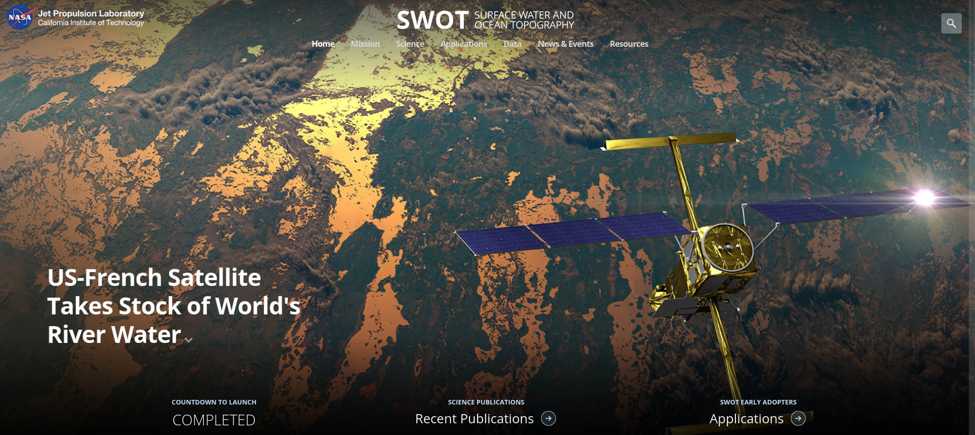
Have you ever wondered how satellites help us understand our planet’s watery surface? You might have heard the buzz around NASA’s SWOT satellite mission, but there’s a lot more beneath the headlines. Sure, satellites have been observing Earth’s ocean and water bodies for decades, but none have done it quite like SWOT is doing right now. Imagine being able to see the world’s lakes, rivers, reservoirs, and even tiny coastal features with detail that was science fiction just a few years back. That’s precisely what SWOT is all about: transforming our knowledge of Earth’s surface water and oceans with global, high-resolution data that anyone—from researchers to city planners—can use.
In this deep dive, we’ll explore everything you need to know about the Surface Water and Ocean Topography (SWOT) satellite. From its mission objectives and engineering marvels to its international spirit and powerful scientific impact, we’ll guide you through the how, why, and wow of this unprecedented space mission. Whether you’re a curious student, a climate professional, or just love cool tech, we’ve rounded up all the essential facts—and a few hidden gems—about SWOT’s revolutionary approach to monitoring our blue planet.
Meet the SWOT Satellite: The Groundbreaking Global Water Surveyor
SWOT stands for Surface Water and Ocean Topography, a joint mission led by NASA and France’s CNES, with critical contributions from the Canadian Space Agency (CSA) and the UK Space Agency (UKSA). After decades of conceptual development and engineering ingenuity, the satellite launched aboard a SpaceX Falcon 9 rocket on December 16, 2022, from California’s Vandenberg Space Force Base. With a launch mass of about 2,200 kg, sprawling nearly 15 meters in length, and powered by a robust 8,000-watt energy system, SWOT is equipped to deliver detailed data for at least a three-year mission, covering about 86% of Earth’s surface between 78° South and 78° North latitudes.
Why is this satellite such a big deal? Previous missions like TOPEX/Poseidon and the Jason series focused on small, select locations or large-scale average data. SWOT, however, was designed to paint the first ever complete global picture of how surface water bodies—rivers, lakes, reservoirs, and oceans—change over time, in both height and area. It’s akin to switching from blurry polaroids to streaming in 4K Ultra HD, allowing scientists and policy makers finer insights for water management, disaster response, and even climate forecasting.
OpenRouter: The Ultimate Guide to Unified LLM Access and AI Integration
Who’s Behind the Mission?
Collaboration is at the heart of SWOT’s story. As a combined venture, NASA (you can check out all the mission details at the SWOT official mission page) teamed up with the French space agency CNES, the Canadian Space Agency, and the UK Space Agency, all bringing unique expertise. This international approach ensures that the data, systems, and results have the broadest impact possible—spanning scientific research, environmental monitoring, public policy, and more.
SWOT was prioritized as one of the leading missions in NASA’s Earth science roadmap, emerging from the 2007 National Research Council’s Decadal Survey. Years of planning, tech development, and cross-continental teamwork made it possible, with renowned scientists in both hydrology and oceanography—such as Professor Paul Bates (Fathom)—actively contributing since the mission’s earliest brainstorming sessions.
Mechanical Engineering Explained: Fields, Careers, and Opportunities
Mission Objectives: Why SWOT Exists
The goals of SWOT revolve around making our understanding of Earth’s water cycle unprecedentedly comprehensive and actionable. Its objectives can be broken down into several key areas:
- Make the world’s first truly global survey of Earth’s surface water, observing millions of lakes, rivers, and ocean features in high resolution.
- Measure changes in water heights and flows, producing actionable data for water management, climate science, and disaster mitigation.
- Detect and map details of ocean surface topography, including small-scale currents and swirling eddies, to improve our understanding of heat and carbon transfer mechanisms on a planetary scale.
- Create a unified database of water resources, supporting transboundary river monitoring, reservoir management, and flood forecasting globally.
How Does SWOT Work? The Science and Technology
At its heart, SWOT is a marvel of precision radar science. The key breakthrough is its Ka-band Radar Interferometer (KaRIn), which uses advanced synthetic-aperture radar (SAR) techniques. By flying two radar antennas at the ends of a 10-meter mast, SWOT can capture the slope and elevation differences across a wide swath—up to 120 km (with a tiny 10 km gap at nadir)—instead of just at a single point beneath the satellite (as “nadir” altimeters did before).
Here’s why this technology is transformative:
- Resolution and coverage: Over the deep oceans, SWOT measures sea surface heights with a spatial posting of 2 km by 2 km, achieving a precision better than 2.7 cm. On land, it’s sensitive enough to distinguish rivers just 100 meters wide and lakes as small as 250 by 250 meters—a previously unreachable feat.
- Repeat and revisit: The satellite circles the Earth in about 103 minutes, and its 21-day repeat cycle ensures fresh data globally in just over three weeks (with an accelerated calibration phase delivering 1-day repeat cycles early in the mission).
- Dual instrument synergy: Alongside KaRIn, SWOT flies conventional Jason-class nadir altimeters, radiometers, and advanced GPS systems, blending the best of old and new for accuracy and cross-calibration.
- Massive data throughput: The mission generates enormous amounts of raw radar data, demanding ground-based supercomputers for processing and analysis—enabling users access to workable, actionable information in near real-time.
The definitive guide to Windows IoT: Editions, features, and Real-World Impact
Breaking Down the Instruments Aboard SWOT
| Instrument | Main Purpose |
|---|---|
| KaRIn | Wide swath interferometric altimetry to measure surface water heights. |
| AMR-C | Advanced radiometry for atmospheric correction and support of altimetry. |
| DORIS | Satellite positioning and orbit determination. |
| GPSP | Global Positioning System payload for enhanced location accuracy. |
| LRA | Laser Retro-reflector Assembly to boost precision in satellite tracking. |
| X-band Telecom | Communications for data downlink to Earth stations. |
All these instruments work in concert to achieve SWOT’s ultra-fine measurements across both land and ocean surface water.
The Importance of SWOT: Science, Society, and Global Benefits
Now, let’s talk impact. Why should the world care about a satellite that tracks water in exquisite detail? The applications are as broad as they are essential—from monitoring river levels in remote jungles to giving early warning of floods in megacities and tracking the currents that steer our climate.
Several key contributions stand out:
- Improved flood monitoring and disaster prediction: By mapping real-time changes in floodplains and river levels, SWOT empowers emergency planners and scientists to predict and manage flood risks better than ever before.
- Climate forecasting and ocean science: Ocean currents, swirling eddies, and sea level changes all play pivotal roles in Earth’s climate. SWOT supplies the detailed, global coverage required to feed next-generation climate models and refine predictions of sea level rise or coastal impacts.
- Water resource management: In a world where water scarcity drives political and economic decisions, having a comprehensive, up-to-date inventory of lakes, rivers, and reservoirs changes the very approach to agriculture, power generation, and regional planning.
- Environmental and public policy: Reliable, unbiased, and globally available water data underpin everything from cross-border water disputes to biodiversity protection, public health, and energy security.
Earth’s Water under the Lens: SWOT in Action
What kind of features does SWOT reveal that were out of reach for previous satellites? The difference lies in its ability to scan broad swaths of rivers, floodplains, and coastal waters, tracking the rise and fall of water levels at resolutions that matter for real-world management. For instance:
- Mapping flood waves: Now, emergency agencies can see the shape and direction of floods, monitor local water levels, and plan responses more effectively.
- Tracking ocean circulation: The mission maps small-scale eddies and currents that mix the ocean, transport nutrients, and regulate heat—critical for fisheries, shipping, and climate research.
- Transboundary river management: Many major rivers cross borders, creating disputes and challenges in sharing water. SWOT’s globally consistent measurements promote transparency and cooperation.
- Model validation in science and engineering: Companies and research labs (like Fathom) now use SWOT’s high-resolution datasets to boost the accuracy of flood risk and climate models—validating theory with real, observed change.
What Is OpenDeck? The Ultimate Guide for stream deck and MIDI Control
Behind the Scenes: Timeline and Operations
Getting SWOT from theory to orbit has been a multi-decade journey. The mission started in the early 2000s with collaborative concept studies, marching through several key phases:
- Pre-Phase A: Concept studies and broad vision planning.
- Phases A-C: Development, design, and fabrication—leveraging lessons from airborne instruments and algorithm development.
- Phase D: Launch and initial “fast-sampling” operational period lasting six months, focusing on daily repeat orbits for calibration and rapid science.
- Phase E: Nominal three-year operations, with a 21-day repeat cycle balancing global reach and data richness.
SWOT’s innovative orbit selection avoids some of the classic challenges—like tidal aliasing—that plagued sun-synchronous satellites, guaranteeing repeated, overlapping observations for the vast majority of the globe. The mission’s open-data policy also means results are accessible not just to academics but also to the public.
What Science Teams and Partners Are Saying
Professor Paul Bates, a leading voice in hydrological modeling and a SWOT Mission Science Team member, puts it succinctly: “SWOT gives us an amazing way of mapping things like floods and droughts in ways we’ve just not been able to do before.” This sentiment echoes across the scientific community, as researchers anticipate refining everything from large-scale flood models to streamflow estimates in regions where ground-based measurements are impossible or dangerous.
Collaborators such as Fathom, an organization specializing in flood risk mapping, highlight how SWOT’s game-changing breadth and granularity allows for improved model validation, especially coupling satellite imagery with cutting-edge machine learning algorithms to extract even deeper insights from water elevation levels and river channel features previously shrouded in mystery.
Data Applications: From Science to Real-Life Impact
How does SWOT data transform daily life, research, and policy?
- Inventory of freshwater resources: With SWOT, experts can, for the first time, assess the volume and quality of freshwater in more lakes, rivers, and reservoirs than ever before. This impacts agriculture, municipal water supply, industrial uses, and even recreation.
- Disaster prevention and response: Detecting the early signature of floods, tracking drought intensities, and predicting flood wave propagation allows communities (even in the remote, politically unstable areas) to prepare and respond with new precision.
- Coastal zone management: Communities along the world’s coastlines now have a tool for monitoring storm surges, coastal erosion, and the movement of pollutants—facts critical for safety, fisheries, and sustainable development.
- Climate adaptation: SWOT data directly feed into the models that inform our adaptation strategies for sea-level rise, coastal planning, and evaluating carbon and heat exchange between land and sea.
Tackling Global Challenges: Cross-Border Water, Health, and Energy
SWOT’s reach doesn’t stop at climate and disaster science. By providing shelf-stable, globally consistent datasets, the mission helps inform the management of transboundary waters—one of the more sensitive geopolitical issues of the 21st century. Equally, SWOT data find roles in:
- Biodiversity and ecosystem monitoring: Water levels in floodplains and lakes are key to habitats for endangered species, migratory birds, and critical wetlands.
- Disease prevention: Monitoring the surface water cycle is crucial for predicting the spread and outbreak of water-borne diseases, including those that emerge in changing climates and after storms.
- Energy planning: Reservoir level monitoring impacts the operation of hydroelectric plants, irrigation planning, and even oil and gas rigs offshore; improved data help avoid blackouts and optimize generation.
Global Collaboration and Open Science
The SWOT mission has defined a new standard in open, collaborative science. With all its data planned for free release, it creates a level playing field for research worldwide, ensuring innovations in flood risk, water balance, and climate modeling are not stifled by cost or access. International oceanographic and hydrological scientists have already organized campaigns to match SWOT’s observations, combining ground-based and satellite data to push the frontiers of our water knowledge.
From its very inception, SWOT’s open-data model encourages contributions by everyone—inviting in-country researchers, students, and even citizen scientists to benefit from and enhance its findings—truly democratizing global earth science.
In a world facing increasing water insecurity, climate change, and extreme weather events, the SWOT mission delivers tools and knowledge that are urgently needed. Its seamless blend of foundational science, cutting-edge technology, and accessible data is transforming everything from weather predictions to flood response, urban planning, and environmental protection. The international teamwork behind SWOT highlights what’s possible when agencies pool brainpower, resources, and determination to tackle global questions. With its high-resolution global measurement of lakes, rivers, oceans, and reservoirs, SWOT isn’t just a satellite—it’s a new vision for understanding and protecting our interconnected blue planet. To stay up to date or dive deeper, you can find the latest on the official .
Mastering Smart App Control (SAC) in Windows 11: Comprehensive Guide