
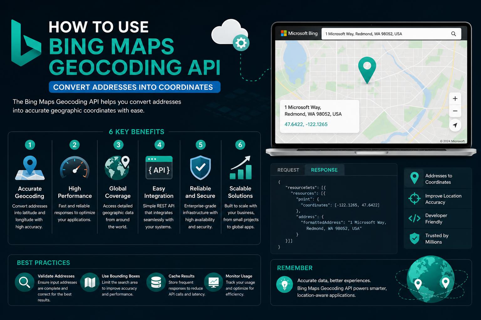
- Bing Maps provides robust geocoding and reverse geocoding capabilities suited for enterprise applications.
- The API supports detailed batch processing and offers flexible schema options for data input/output.
- Migration from Bing Maps to Azure Maps is mandatory for long-term projects as Bing Maps retires in stages.
Bing Maps remains one of the leading mapping solutions for developers aiming to add location-based services to their applications. Whether powering logistics, customer fulfillment, or asset tracking, pinpointing geographic locations through geocoding is an essential building block for innovative apps and robust business analytics. Over the years, geocoding technology has evolved to enable both simple and complex spatial data use cases, and Microsoft’s Bing Maps Geocoding API brings a host of powerful features to the table. This detailed guide will walk you through everything you need to know, helping you leverage the full capability of Bing Maps for geocoding, reverse geocoding, and large-scale spatial data processing.
With organizations seeking ever more accurate geographic data to support logistics, decision-making, and customer experiences, geocoding plays an increasingly crucial role in modern software. The Bing Maps Geocoding API delivers high-precision location data, integrates with diverse systems, and comes with advanced features to process vast address sets in bulk. If you’re looking to utilize Bing Maps Geocoding to its fullest, this article will give you not just the basic principles, but a comprehensive overview, practical suggestions, and up-to-date guidance for successful API integration.
Understanding Geocoding: The Foundation
Geocoding is the process that converts text-based addresses into latitude and longitude coordinates, allowing digital systems to map, visualize, and analyze geographic information. Whether you’re handling classic street addresses, postal codes, business names, or even informal queries, geocoding bridges the gap between human-friendly input and computer-friendly coordinates. The reverse process, known as reverse geocoding, converts coordinates back to readable places or addresses.
The demand for accurate geocoding originates from the need for businesses to manage addresses, analyze customer locations, optimize deliveries, or build interactive maps for users. For example, e-commerce companies depend on geocoding to accurately plot delivery locations. Similarly, geocoding underpins asset tracking, location-based marketing, CRM data enrichment, and spatial analytics across virtually every industry sector.
Bing Maps Locations API: Features & Methods
The Bing Maps Locations API serves as the primary endpoint to convert address data to geospatial coordinates or retrieve addresses from coordinates. This API provides flexible methods to accommodate diverse requirements, from direct address lookups to free-form queries and even recognition of points of interest like businesses or landmarks.
- Find by Address: Input structured address data (like city, postal code, or street) to retrieve precise latitude and longitude coordinates.
- Find by Point: Supply latitude and longitude to receive comprehensive location details, supporting both geocoding and reverse geocoding scenarios.
- Find by Query: Leverage a free-text query (e.g., “Times Square, New York”) to get matching geographic coordinates along with additional metadata.
- Location Recognition: Identify and extract local businesses, natural landmarks, and richer contextual information for a given coordinate.
- Local Search: Use text queries or business types to discover nearby businesses, providing the groundwork for store locators or neighborhood analysis.
The API’s versatility ensures developers can extract accurate location data, even from partial or ambiguous input, and easily integrate this data into their applications.
The Role of the Geocode Dataflow API: Batch Processing at Scale
For enterprises and developers handling significant volumes of addresses, Bing Maps’ Geocode Dataflow API provides powerful batch processing capabilities. Rather than geocoding single addresses in real-time, the Dataflow API allows submission of massive datasets, with support for both geocoding (address to coordinates) and reverse geocoding (coordinates to address).
The Dataflow model operates as follows:
- Format Your Data: Prepare your address data in the required schema – either version 1.0 or, preferably, the more flexible version 2.0. Supported file formats include XML and delimited text (comma, tab, or pipe).
- Create a Batch Job: Submit the formatted data to the API via REST or HTTP POST. A job is created and a status endpoint is returned for tracking progress.
- Monitor Job Status: Poll the status endpoint to monitor the job’s processing state. This step’s speed depends on the uploaded data volume.
- Download Results: Upon completion, retrieve your fully geocoded data within a 14-day window, ready for immediate integration into CRM, operational tools, or analytics platforms.
Bing Maps supports up to ten concurrent jobs for enterprise accounts, with both input and output supporting modern, developer-friendly schemas for data compatibility. Each schema upgrade brings added flexibility, improved information granularity, and smoother interoperability with related APIs, like the Locations API and Data Source Management capabilities.
Schema Versions Explained: v1.0 vs v2.0
Schema selection plays a vital role in how your application interacts with the Dataflow API, impacting both data flexibility and the range of geocoding information returned.
- Version 1.0: The original data format. Existing users can continue to use v1.0, but it lacks some features and compatibility introduced later.
- Version 2.0: Offers richer geocoding details, including multiple geocode points for routing and bounding boxes for display purposes. It also standardizes response fields to better align with the modern Bing Maps REST Services Locations API, providing developers with more consistent and actionable output.
For new projects, version 2.0 is highly recommended due to its expanded capabilities and improved data richness. Migration from v1.0 to v2.0 is encouraged, with attention to changes in naming and structure.
How Geocoding Works Under the Hood
Effective geocoding requires more than simply submitting an address. The system’s accuracy depends on several crucial factors, including the quality of the address data and the robustness of the underlying geocoding algorithm. Bing Maps leverages extensive Geographic Information Systems (GIS) datasets, historical mapping tools, and cutting-edge algorithms to ensure high accuracy, even when addresses are imperfect.
- Absolute Addresses: Direct, self-contained address details—such as full street names, postal codes, or well-known landmarks—are typically straightforward for the API to geocode.
- Relative Addresses: These rely on other points of reference (e.g., “opposite Central Park”) and require additional interpretation. Advanced algorithms and contextual datasets help improve results for these cases, but overall accuracy may still vary versus absolute queries.
Challenges can arise when handling inconsistent, incomplete, or misspelled data, or when geocoding in regions lacking detailed map coverage. Techniques like GPS interpolation and machine learning models help boost geocoding success even in areas with limited reference data. Innovative tools—such as place codes and alternative datasets—continue expanding the possibilities for difficult locations.
Common Use Cases for Bing Maps Geocoding API
- Store Locator Applications: Businesses with multiple physical locations often use batch geocoding to transform addresses into map coordinates for store locator tools or branch network visualization.
- Delivery Optimization: Accurate coordinate data supports route planning, dynamic delivery tracking, and logistical improvements that save time and resources for transportation companies, retailers, and food delivery platforms.
- CRM and Data Management: Converting customer addresses into standardized geographic points streamlines CRM processes, improves data quality, and enables detailed customer segmentation based on location.
- Spatial Analysis and Business Intelligence: Geocoded data enables visualization of hotspots, customer trend analysis, and strategic decision-making for expansion or marketing.
- Asset and Fleet Tracking: Combining geocoding with GPS data helps organizations monitor their assets, optimize coverage, and respond efficiently to real-time changes.
Utilizing reliable geocoding processes reduces data ambiguity, shrinks server loads, and minimizes errors related to free-text address inputs.
Limits, Licensing, and the Future: Bing Maps Transitioning to Azure Maps
It’s important for developers to stay informed about licensing changes and upcoming platform updates. Microsoft has announced the phased retirement of Bing Maps for Enterprise:
- Enterprise Accounts: Service continues until June 30, 2028.
- Free (Basic) Accounts: Service continues until June 30, 2025.
Microsoft recommends migrating to Azure Maps, the platform that offers similar and enhanced geospatial features, scalability, and integration options. Migration documentation and timelines are available in the Bing Maps Dev Center, facilitating a smooth transition.
Although Azure Maps provides many comparable functionalities, some address or dataset specifics may differ. Developers should verify critical address components and response details when planning migration.
Getting Started: Obtaining an API Key and Access
Access to Bing Maps APIs requires an API key for authentication, usage tracking, and quota management. There are two main key types available:
- Basic Key: Suitable for testing and small projects, it is easy to obtain and free for low or moderate usage.
- Enterprise Key: Designed for high-volume applications needing higher limits and dedicated support. Licensing details can be found through Microsoft’s official channels.
Note that Microsoft is no longer accepting new enterprise accounts for Bing Maps, emphasizing the transition to Azure Maps for future development. Existing users are encouraged to prepare for migration.
Addressing Common Developer Questions
- Address & Coordinate Management: Use the Data Source Management API to handle large datasets, complementing the Geocode Dataflow API for efficient data updates and retrievals.
- Query vs. Address API Calls: The Locations API supports both human-readable query strings and structured address components for more precise control and accuracy.
- Bing Maps vs. Azure Maps Data Differences: Some developers observe variations in detail level; testing both options ensures compatibility with all project requirements.
Nancy Grace Roman Space Telescope: NASA’s New Flagship for Exploring the Universe
Best Practices for Maximizing Geocoding Success
To enhance geocoding accuracy and efficiency, consider the following strategies:
- Ensure input data is clean and standardized to reduce ambiguity and improve matching results.
- Adopt the latest API schemas, especially v2.0, to benefit from richer data and better consistency.
- Proactively monitor batch jobs to manage resources effectively and ensure timely results.
- Validate critical results in regions with known data quality issues or complex locations.
- Stay informed on Microsoft’s roadmap through official documentation for future updates and migration planning.
Sample Geocoding Job: A Practical Example
Here is an overview of batch geocoding using Bing Maps:
- Prepare your dataset, such as a list of store locations, formatted as CSV, XML, or other suitable formats.
- Format data according to the recommended schema (v2.0), ensuring completeness for better results.
- Submit the batch request via the Geocode Dataflow API, which manages job creation and processing, providing a status URL for tracking.
- Check progress and download completed geocoded data (latitude/longitude pairs).
- Integrate the results into your business systems for mapping, reporting, or analytics tools.
https://learn.microsoft.com/en-us/bingmaps/spatial-data-services/geocode-dataflow-api/
Migration Resources: Preparing for Azure Maps
As Bing Maps transitions to Azure Maps, Microsoft provides comprehensive guides and resources to facilitate migration. Developers should:
- Visit the for updates, timelines, and guidelines.
- Create a free to explore the platform and verify features.
- Review migration guides to ensure continuity and compatibility, especially as Bing Maps for Enterprise service phases out.
Microsoft’s Bing Maps Geocoding APIs provide a robust foundation for geospatial projects, with capabilities spanning real-time address lookup to extensive batch processing. Although migration to Azure Maps is on the horizon, Bing Maps remains effective for high-precision geocoding, data integration, and spatial analysis, supporting a wide range of enterprise needs. Proper input formatting, up-to-date schemas, and batch management empower developers to unlock insights and future-proof their location-based solutions.