
- Up-to-date guidance on using Bing Maps' measurement tools and Distance Calculator API
- Essential troubleshooting and alternative options in case classic tools are missing
- Explanation of developer options like the Bing Maps Distance Matrix API for advanced users
Bing Maps offers powerful features for measuring distances, planning trips, and analyzing routes—yet many users overlook its advanced capabilities. If you’re frustrated by missing tools or outdated instructions, or if you want more than the basics, you’re in the right place. In this guide, you’ll discover everything you need to know about measuring distances, areas, and more in Bing Maps, including using its built-in tools, resolving current interface limitations, and taking things to the next level with developer APIs and add-ons.
Whether you’re an everyday user trying to find the quickest way across town, a teacher planning an interactive geography lesson, or a developer solving complex routing challenges, Bing Maps can support your needs. This article shares practical, tested solutions for current and classic Bing Maps, explains troubleshooting in the new Beta, and walks through advanced methods like the Bing Maps Distance Matrix API for bulk measurement tasks.
What Measurement Options Does Bing Maps Offer?
Most people start with Bing Maps’ built-in measurement tool to quickly calculate the distance between two points, plot a route, or determine the area of a specific region. The classic Bing Maps interface—accessed via bing.com/maps—comes with an easy-to-use measurement function. However, recent interface updates, especially in the Beta version, have introduced some confusion about where and how these features appear.
Using Bing Maps Measurement Tools: Current State and Troubleshooting
If you visit today, you might notice that the measurement tool isn’t always visible or works differently depending on the version. Over the last few months, several users have reported that Bing Maps Beta hides or removes the familiar “Measure Distance” option. Here’s how to handle this:
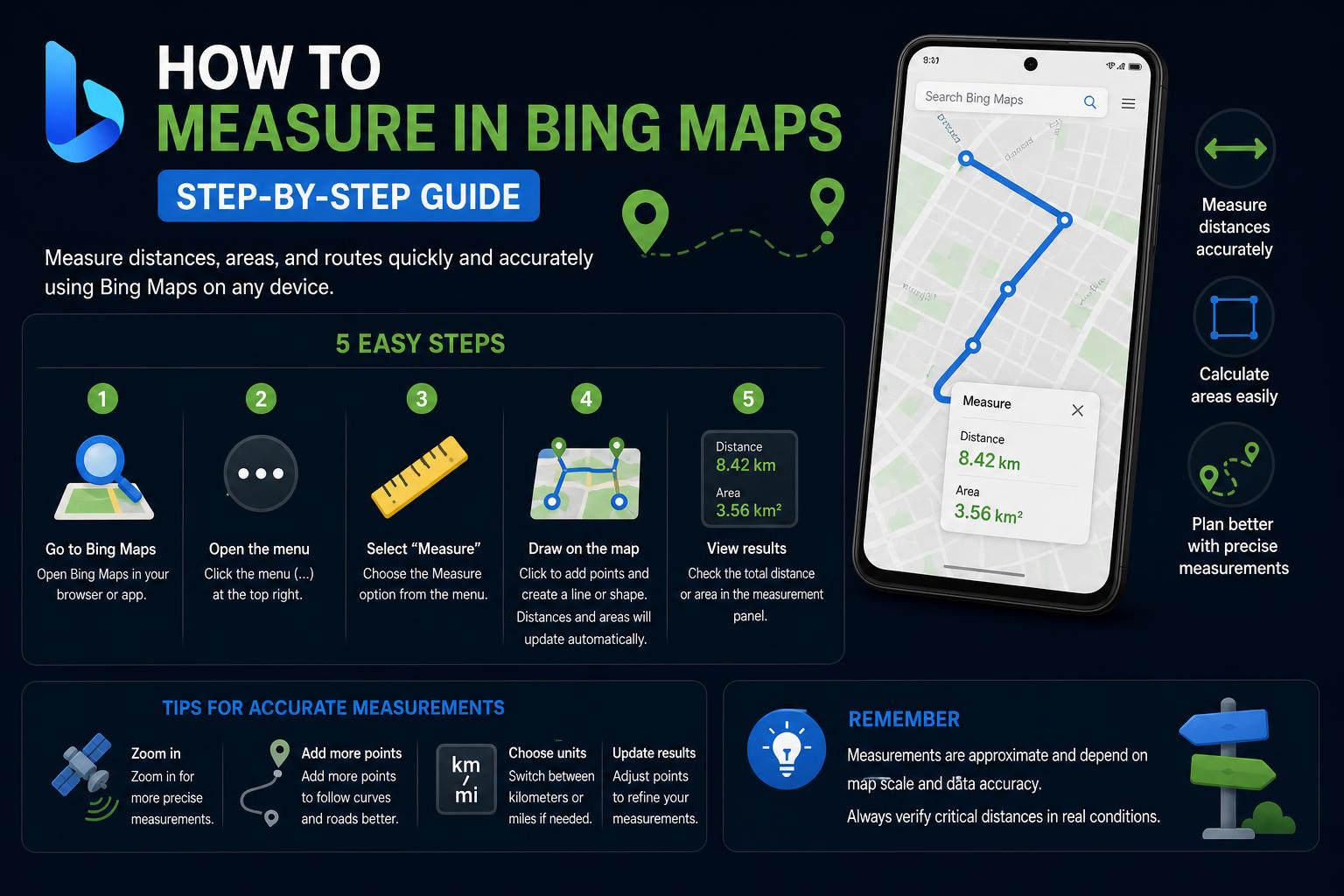
- Check the Menu: In Bing Maps Beta, click the menu icon (☰). Look for options like “Measure Distance” or “Measure Area.” If you see them, select your tool and use your mouse to click start and end points on the map.
- Exit Beta for Classic Experience: If you can’t find the measurement tools in Beta, check the footer for an “Exit Beta” link. Clicking it should load the classic Bing Maps, where measuring tools are reliably present.
- If No Exit Option Exists: Sometimes, there’s no obvious toggle to revert. In such cases, try accessing Bing Maps from a different browser or private/incognito mode. The interface may display differently depending on your cookies and browser profile.
- Send Feedback: If you’re stuck in Beta with missing features, use the built-in feedback button (usually a speech bubble or icon in the lower corner) to report the missing tool. Microsoft often brings back popular features based on user input.
Classic Bing Maps: Step-by-Step Guide to Measuring Distances
- Open Bing Maps and search for your starting location. Right-click anywhere on the map and select “Measure Distance.”
- Add a second point: The map will automatically draw a line and show the cumulative distance in the units you’ve chosen (miles or kilometers).
- Keep adding points: You can plot complex routes by adding multiple points one after another; Bing Maps calculates the total distance instantly.
- Finish the measurement: When you’re done, double-click or select “Finish measuring” to wrap up. The total distance will remain visible until you close the tool.
When Bing Maps Measurement Tools Are Missing
Occasionally, even after switching versions, the measurement tool disappears completely. This issue is more common after interface updates or in recent deployments/Beta versions. If you simply can’t find the option:
- Try different browsers or devices: Sometimes the classic interface loads in Internet Explorer or legacy Edge, even when it’s not available in other browsers. Try switching browsers or devices to trigger the classic version.
- Use the feedback channels: Using the feedback button doesn’t just alert Microsoft—sometimes it also unlocks more interface options by “resetting” the view with new preferences.
- Check third-party add-ons: Some browser add-ons or third-party extensions can restore or enhance measurement tools in Bing Maps. Always check their reliability before using them.
The Ultimate Guide to Bing Maps Geocoding API: Features, Best Uses, and Migration
Bing Maps App Features: Driving Distance, Gas Prices, Parking & More
Bing Maps isn’t just for measuring in a straight line. Its built-in distance calculator, along with features for gas prices and parking location, make it easy to plan complete trips.
Using the Distance Calculator App
- Add destinations and waypoints: Type in each place you want to visit, reorder them, and watch the route update in real time. The calculator also lets you drag and drop segments to customize the trip.
- Compare travel modes: The icons next to the route show whether it’s by car, on foot, or by public transport, along with the distance in miles or kilometers.
- Edit the route: Drag the end points or waypoints and Bing Maps will automatically update the geocoding for the new position.
- Total length: When you add more than two stops, the app will show the mileage between each pair and the total trip distance.
Understanding Microsoft Power Platform: The Ultimate Guide for Beginners and Pros
Gas Prices and Gas Station Locator
Parking Finder
Switching Map Modes
Advanced Distance Calculations: Bing Maps Distance Matrix API
Core Use Cases
- Route optimization: Ideal for solving problems like the traveling salesman or distribution routes, thanks to its updated matrices.
- Sorting results: Sort businesses or homes by distance or real-time travel time from a given point.
- Geographic filtering: Find groups of locations within a certain time or distance range to plan visits or trips.
API Request Details
Billing, Quotas, and Limits
Educational and Classroom Use
- Activity ideas: Students can plot routes, compare coastal versus inland distances, or explore areas reachable within a certain time.
Developer Resources and Demo Projects
- Bing Maps Blog: How-to guides, use cases, and tips for making the most of Bing Maps features.
- Bing Maps API Sample Gallery: Live examples and advanced demos.
What is Bing Maps? Complete Guide, Features & Global Coverage